Sbilf
Guest
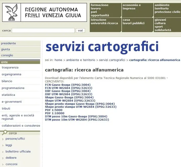
Good evening to all,
I need to convert files that the fvg region publishes (regional technical papers) in a neutral 3d format.
ideal for me is to receive a file format iges (.igs) , dxf , or step (.stp)
what the public region is in the attached image.
that files should I download to convert them later to a 3d file? .
I have already downloaded the dxf, but it is 2d in white/black (extensible cause scale 1:1)
Thank you.
cordial greetings
Sbilf